
October 2025 updates: Pilot work and performance updates
We spent a good chunk of late September and early of October in the field. James worked with Nigeria's Ministry of Health, we started a new pilot in Liberia, and kept Guinea-Bissau and Kogi moving forward. A few of these updates we shipped this month came from problems we saw while supporting the pilots.
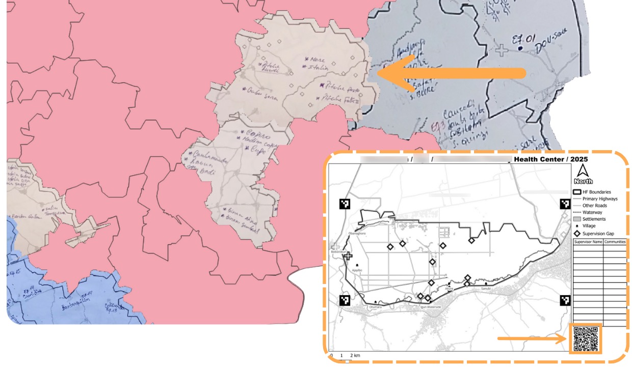
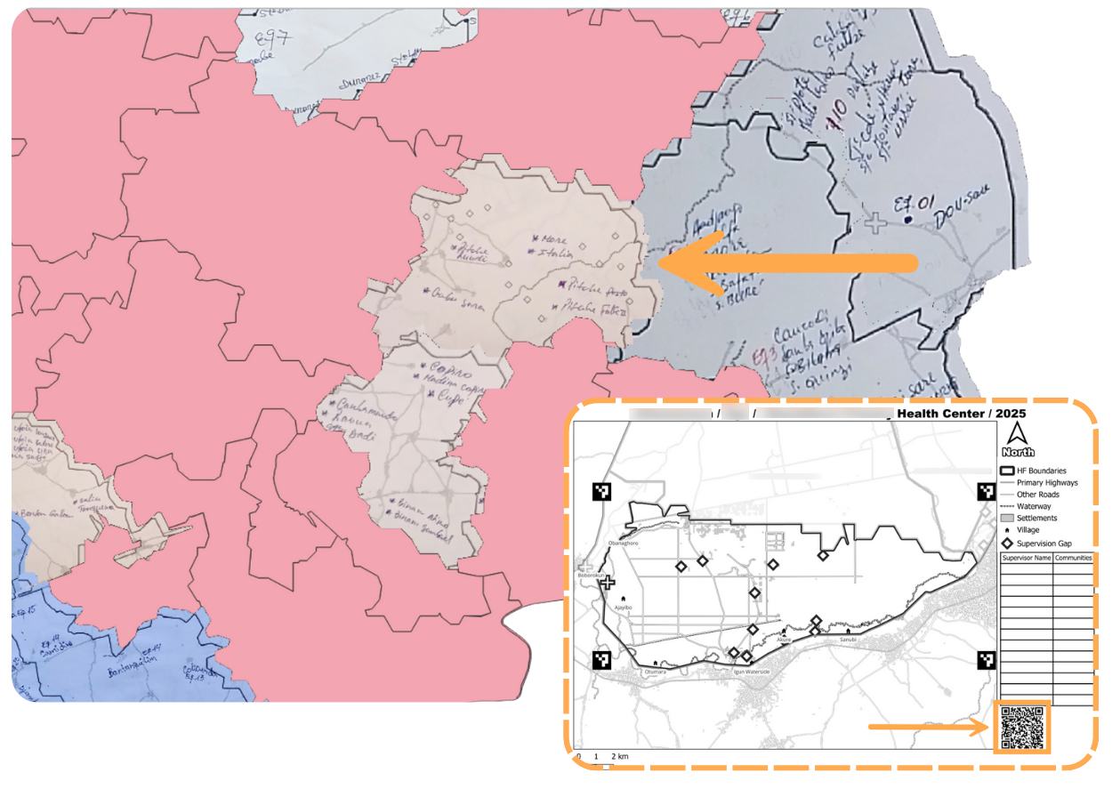
Mapping supervision gaps in Nigeria
James spent two days training about 50 people from the states of Edo, Enugu, Ebonyi, and Cross River. Training covered ESPEN Geospatial Microplanner (a WHO white-label version of our app) to prepare for an upcoming Onchocerciasis campaign. James focused on using our site-based catchments to visualize where supervisors actually went during last year's campaign.
We were able to take the participants’ ODK data from that campaign and used our app’s Point of Interest tool to pin those areas that needed further attention. We'll share more details on this work and how to use POI for better planning next month.
Hack Week improvements
We wrapped up our second hack week in October. The focus was fixing zooming issues on larger countries where sections would go blank or the interface would freeze. We rebuilt the merging logic to respect catchment boundaries, built our own tile system, and fixed the equator bug. Now you can zoom smoothly across entire countries without sections disappearing.
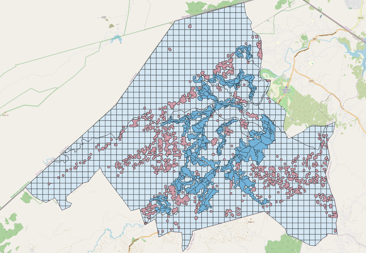
Land blocks get (even) cleaner
We continue improving how land blocks (the base layer for our maps) work behind the scenes. The new grid-based update gives users the same level of detail without the strange-looking polygons that used to crop up sometimes. Smaller file sizes means faster loading times for your projects.
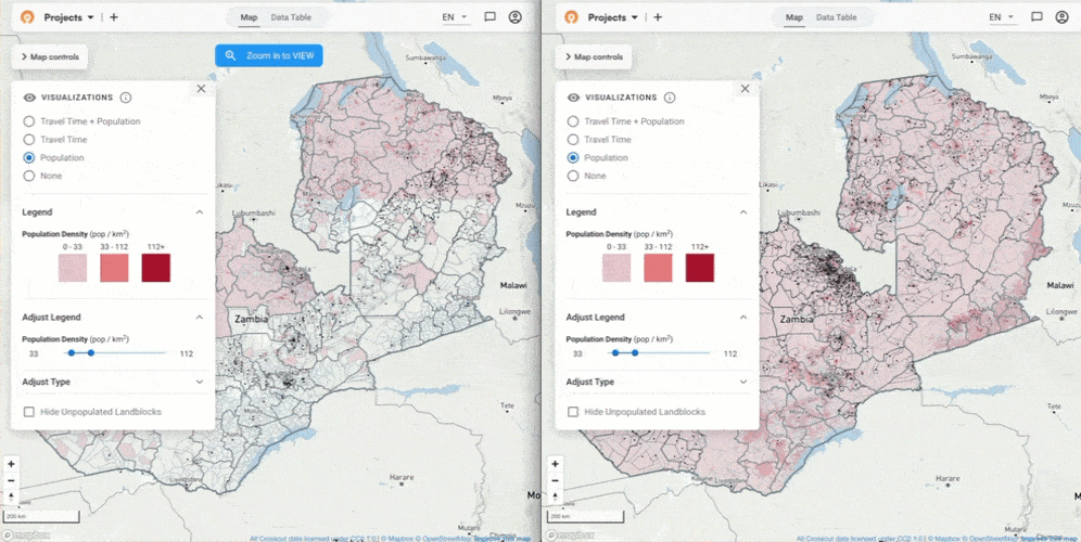
Better population data
WorldPop just released their 2.0 dataset, and we're loading it into all our countries. This addition means more current population estimates and new disaggregations by age and gender. You won’t notice any visual changes, but now the numbers you're working with are more up to date.
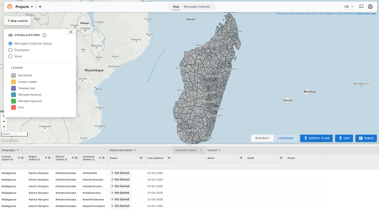
Madagascar now available
The entire country of Madagascar is now in the app to create catchment maps and use the Microplan Collector. We continue working with our partners to add new countries to the app.
Working with weak connections
James ran into issues trying to access basic app features while in Nigeria. We took that feedback and tweaked the timeout settings to improve app performance on weaker connections. Field teams, remote health facilities, and in-person training often work with limited bandwidth, so having reliable access is important.
Satellite view and points of interest
You can now turn on satellite view while in the background of the accessibility view. This option can help orient planning teams to realities on the ground they might miss (whether settlements are separated by rivers, admin boundaries, forests, or marshland). Satellite view helps answer things like: “Is it possible that this group of settlements are difficult to reach because of marshy terrain?”
When you download points of interest as a CSV, the file includes the administrative units they belong to. Previously you just got the category, name, and GPS coordinates. Now you can quickly filter by district or region without cross-referencing other files.

QR codes for printed maps (in progress)
We're working on something new for field teams with connectivity issues. When the tool goes live, you’ll be able to print a map, mark it up with a pen in the field with key landmarks or operations boundaries, scan a QR code with your phone, and send us a photo. We georeference it on our end. Still actively developing it, but the early version is working.
Microplan Collector updates
We made a handful of updates to improve the workflow within the Microplan Collector:
- Historical population data in templates. Teams can now compare current campaign estimates against data from previous campaigns, alongside the third-party baselines that were always available.
- Direct population editing. Before the updates, when you spotted questionable data using the outlier tools, you had to make notes for follow-up. Now you can edit the final population numbers directly while you're reviewing.
- Admin names in emails. When one person is submitting data for multiple areas, the subject lines and filenames now make it clear which dataset is which.
- Reference IDs in files. Forwarding templates in new email threads used to break our automatic tracking. The tool now pulls the Reference ID from the file itself instead of the email, so tracking works no matter how you submit them.

What's driving these changes
The timeout issue came up because James couldn't access the app during training. The historical data feature came from teams asking how their current estimates compare to last year. The Reference ID fix came from watching submission workflows break when emails got forwarded incorrectly. Satellite view helps spot potential access issues in the field.
Everything we build goes into the free version of the Crosscut App. If you want to keep up with these updates, you can sign up for our monthly newsletter. For more specific help, reach out through our Advisory Services.
Related Posts
Choosing the right catchment area mapping method in the Crosscut App


DHIS2 Annual Conference 2026
.JPG)

How to create catchment area maps in DHIS2 with the Crosscut App
