
Blog
Thank you! Your submission has been received!
Oops! Something went wrong while submitting the form.
Help
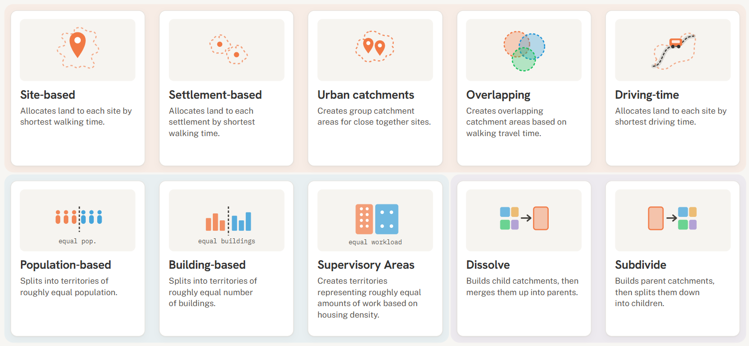
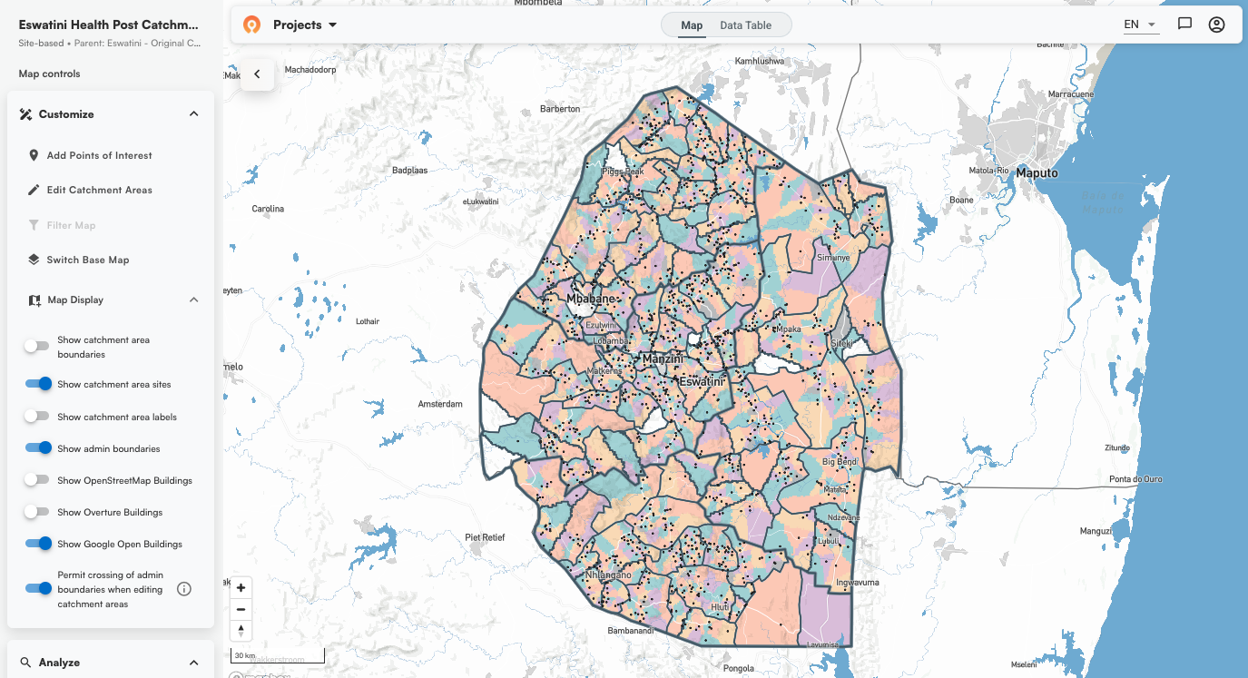
Choosing the right catchment area mapping method in the Crosscut App
A guide on the eight algorithms in the Crosscut App for building catchment area maps, what each one does, and how to pick the right one for your program.


News
DHIS2 Annual Conference 2026
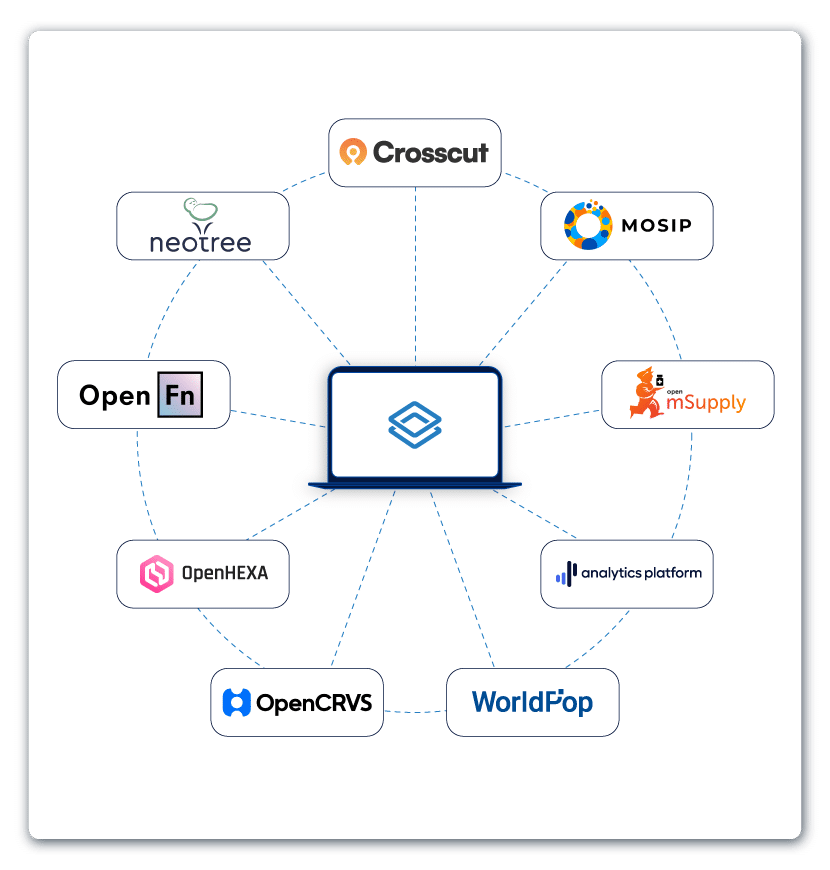
We were in Oslo a few weeks ago for the DHIS2 annual conference. As one of the DHIS2 Strategic Technology Partners, Crosscut had a chance to present our technology.
.JPG)

Help
How to create catchment area maps in DHIS2 with the Crosscut App
Learn how to create free catchment area maps in DHIS2 with no technical skills required.

News
How the Crosscut App helps plan health campaigns in Nigeria
In Nigeria we plan onchocerciasis campaigns with the Carter Center and schistosomiasis campaigns with Sightsavers, working with Ministries of Health across eight states.


News
An independent evaluation of the Crosscut App
Read through an external evaluation of our 2025 country projects with WHO's Expanded Special Programme for the Elimination of Neglected Tropical Diseases (ESPEN).

Help
How to set up a Microplan Collector project in the Crosscut App
This guide shows how to use the Microplan Collector, letting planning teams continue using the email and Excel workflows most health programs already use.
App Development
May 2026 updates: Shared microplan projects and easier supervision analysis
From project sharing to raster data aggregation, here's what we built in May and why it matters for programs running global health campaigns.
Help
How to find the communities your health campaign is missing
Health program lists are never complete. Learn how to use fuzzy matching, printed catchment maps, and gap analysis to find the communities your program isn't planning for, and get them on a map.
News
How catchment area maps calculate travel time accessibility
Almost all applications offering accessibility maps use one of these two approaches.
Help
How to create catchment areas within catchment areas
Learn how to use an existing catchment map as the boundary for a new one, including catchments you build around geocoded points.
News
The Crosscut App is now a DHIS2 Technology Partner
DHIS2 named Crosscut a Strategic Technology Partner in its inaugural cohort. Find out what the partnership program is, and how the Crosscut app brings catchment area mapping into DHIS2.

App Development
Printable catchment area maps for more precise health campaign planning
Learn about printed catchment area maps for health campaign planning.
