
Contributing Open Catchment Data Through HDX
The Crosscut App is certified as a digital public good in the open data category. What that means practically is that all our settlement catchment outputs are freely available for anyone to use, and there’s no attribution required. One of the main ways we share this data is through the Humanitarian Data Exchange (HDX).

While we don’t talk much about these contributions, HDX staff recently told us we have one of the most downloaded datasets on the platform. That surprised us, honestly. We can't see who's using the data or what they're doing with it since it's all anonymous. But knowing that well over a thousand people have downloaded these catchments shows they're filling a real gap.
What makes settlement catchments different
Organizations like WorldPop and Grid3 produce maps showing populated areas as individual dots or polygons across a country. These are incredibly useful datasets that show where people live at a granular level, but not how populated areas relate to each other for planning purposes.
What our settlement-based catchments do is lasso boundaries around these settlements in logical groupings. The app finds the largest settlement centers and creates clusters around them, because communities never exist in isolation from one another. Groups of villages typically connect to a central town for services, food markets, and healthcare.
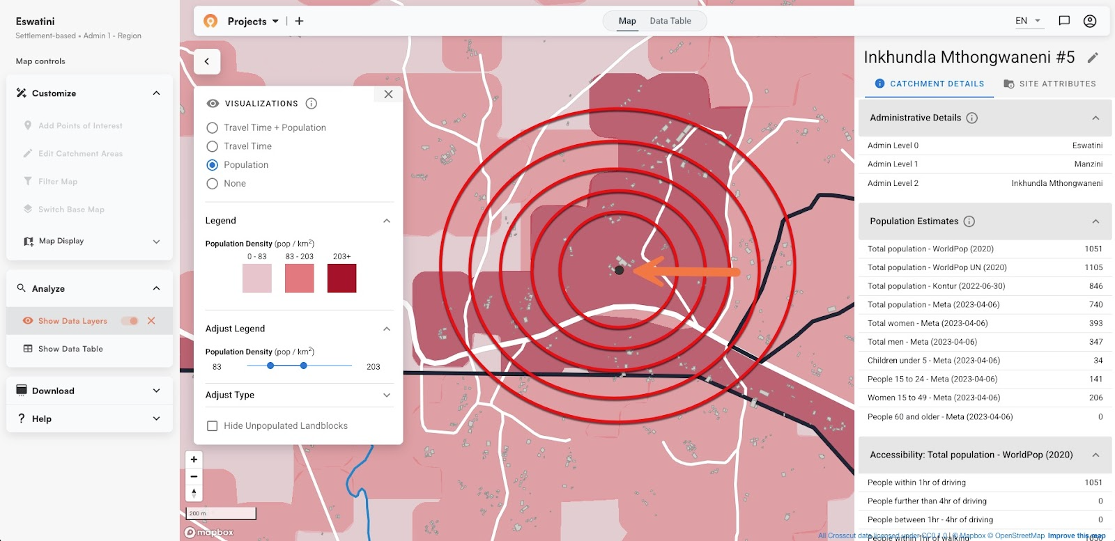
Unlike site-based catchments, which use your specific facility locations as input, these are built from where communities gather. That makes them general-purpose infrastructure that works whether you have facility coordinates or not. This is probably why the files gets downloaded so frequently – you can use it immediately without needing to first map all your service points.
The DRC example
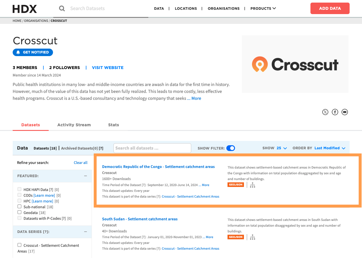
Take our Democratic Republic of Congo dataset on HDX as an example. With over 1,600+ downloads, it includes catchments for the entire country, broken down by province. Each file contains thousands of settlement-based catchments with their associated population data. These files are refreshed annually as new population estimates and settlement information becomes available, so teams can rely on them staying current.
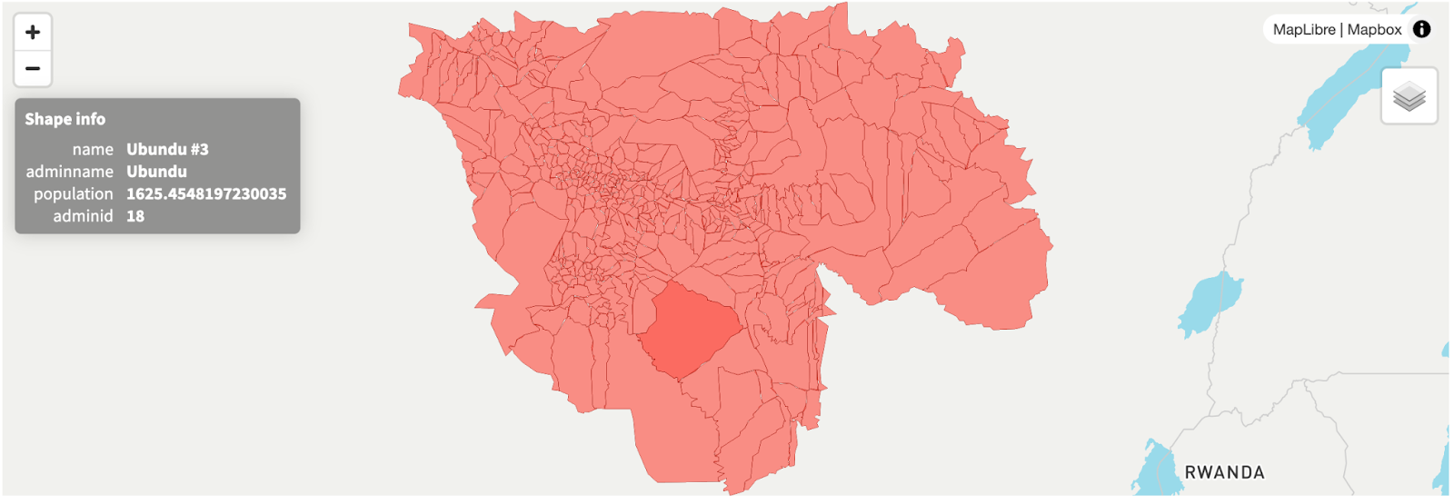
When you click into a specific catchment on the map, you see information like the settlement name, which administrative area it belongs to, total population, and the administrative ID for linking to other systems (like DHIS2). For a catchment called "Ubundu #3" in the Tshopo region, the data shows a population of about 1,625 people tied to the Ubundu administrative area.
This level of detail matters if you want more efficient planning. If you're organizing a health campaign or trying to figure out supply distribution, you need to know not just where people live, but how many people, how they cluster together, and which administrative structures they use.
How teams actually use this data
The HDX downloads work with any GIS software or analysis workflow – not limited to the Crosscut App. Based on what we've heard, the data gets used for several different purposes:
- Sample frames - When conducting surveys, teams need to select representative locations and population groupings. Settlement catchments provide a ready-made framework for stratified sampling.
- Coverage analysis - Understanding which communities a health facility or distribution point actually serves. Instead of guessing based on administrative boundaries, teams can see which settlements cluster together geographically.
- Outreach planning - Assigning service territories to field teams during campaigns. The catchments show natural groupings that make sense for team deployment rather than arbitrary lines on a map.
- Place name matching - Each catchment includes settlement names, which helps with the messy work of linking different datasets that spell locations differently or use local versus official names.
Most people downloading this data are likely loading it into QGIS or ArcGIS, integrating it with their own systems, or combining it with other datasets. That's exactly what we want – the data becomes infrastructure that fits into whatever workflow makes sense for the end users.
Why open data matters
The digital public good certification is important to us because we're not trying to lock people into our platform. If a Ministry of Health team in DRC needs catchment data but doesn't have GIS expertise or software budgets, they can download our data and start using it immediately. No licensing fees, no negotiations, no vendor lock-in.
These contributions also help with partner acceptance. When we talk to implementing organizations about pilot projects, contributing open data and having digital public good status makes those conversations easier. This work clarifies we're building shared infrastructure.
As with the DRC files, each file carries more than just a boundary. You also get population by age and sex, building counts, and administrative tags. That’s what makes them ready to connect with platforms like DHIS2, which many countries already use for planning and reporting.
Building on this work
This HDX work ties into our September pilot projects supporting WHO's geospatial microplanning with The Carter Center and Sight Savers. But the open data potentially supports hundreds of other organizations across Africa, including vaccination campaigns, education programs, supply chain logistics. We don't know who's using it and we don't need to know.
Even without that specific user information, the download patterns help us prioritize contributions. When certain countries or regions get downloaded more frequently, it suggests where data gaps are most acute. That feeds back into which areas we focus on for updates.
We'll keep expanding the settlement catchments available on HDX as new population data becomes available. For teams that need catchment data in countries we haven't covered yet, the Crosscut App can generate custom catchments for most locations.
The goal is to make settlement catchment data freely available so teams spend less time on basic geography and more time on delivering services that really matter.
All Crosscut settlement catchment data is available through HDX under open licensing. No registration or attribution required – just download and use.
Related Posts

How to create catchment area maps in DHIS2 with the Crosscut App
.JPG)

How the Crosscut App helps plan health campaigns in Nigeria


An independent evaluation of the Crosscut App
