
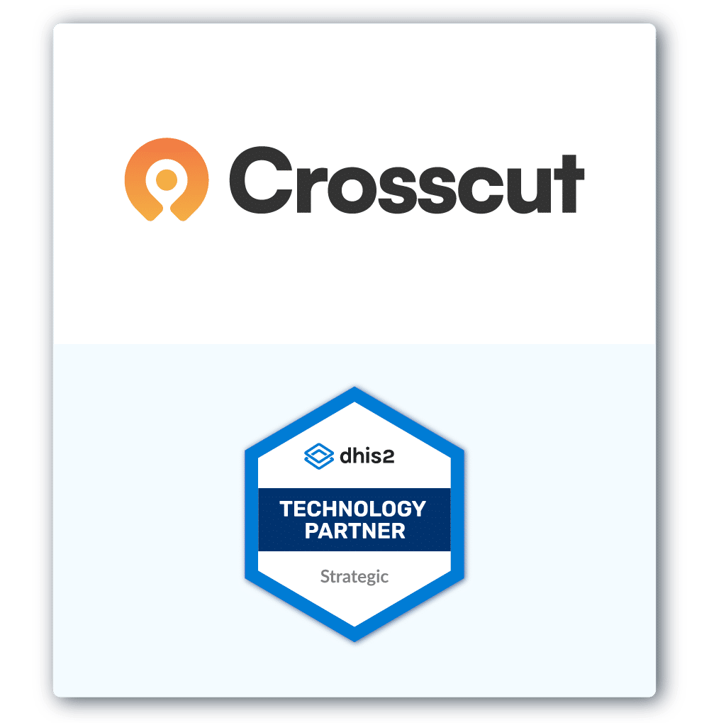
The Crosscut App is now a DHIS2 Technology Partner
DHIS2 is the world's largest open-source, web-based health management information system. The tool covers 134 countries across nearly every disease program and level of the health system. That reach makes it a platform everyone wants to claim a connection to, which is exactly why governments and health programs have a hard time figuring out which integrations and technologies actually do work within the DHIS2 ecosystem.
Last week, DHIS2 took a concrete step toward answering that question. They launched a formal Technology Partnership Program and named an inaugural cohort of Strategic Technology Partners. The Crosscut App is part of the first group.
A formal vetting layer for a noisy global health ecosystem
Scott Russpatrick runs the DHIS2 partnerships program out of the University of Oslo. For years, ministries of health and implementing teams have asked which tools they can use and trust to plan campaigns. Their team had no official answer. This program offers a vetted list of tools with active integrations, and sustained engagement that DHIS2 is willing to stand behind publicly.
During the launch webinar, Scott explained that governments and implementing organizations were routinely building custom planning tools from scratch. Not because better options don't exist, but because they don't know about them or don't know how to evaluate them. The partnership program changes that.
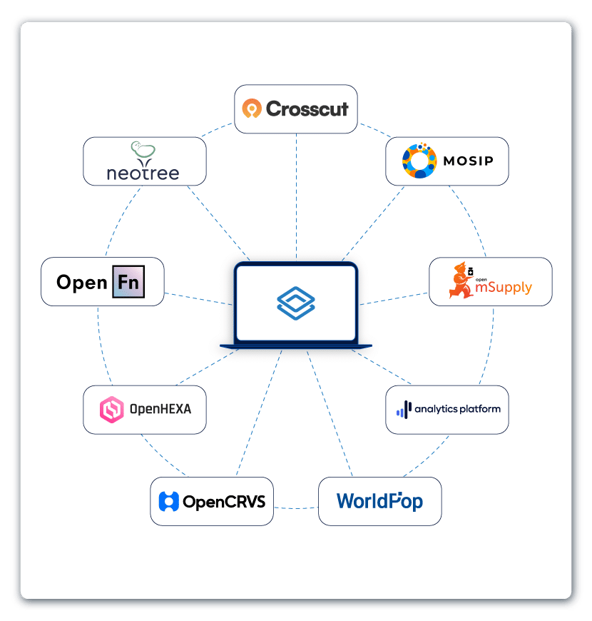
Our first cohort is small by design. DHIS2 wanted to start with a limited group, work out the governance structure, and build on what works. Every partner in this first batch is a digital public good, aligned in values and use case, and in most cases engaged with DHIS2 for years already.
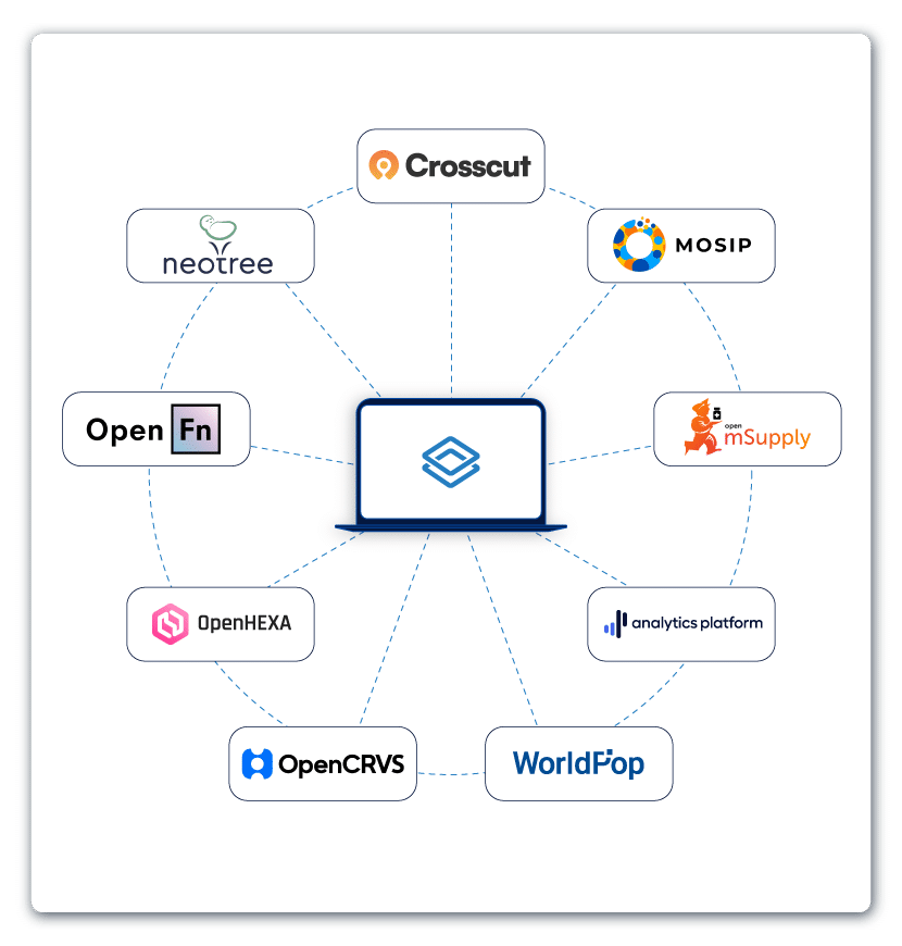
Crosscut is at the Strategic Technology Partner tier alongside WorldPop and others operating in this space. Strategic partners get joint documentation, input on the DHIS2 roadmap, co-developed technical resources, and attend the DHIS2 annual conference in Oslo this June.
How we joined forces with DHIS2
Our relationship with DHIS2 goes back to 2022. I had reached out to Scott and Bjorn Sandvik after noticing their team working on catchment area mapping solutions, and it grew from there into a microplanning app in the DHIS2 App Hub. We published the source code on GitHub, and a signed memorandum of understanding with the HISP Center at the University of Oslo.
The app was named a DHIS2 App-of-the-Year Finalist in 2022. In 2023, the DHIS2 core team added it to their Maps Academy curriculum and trained over 50 Ministry of Health staff from more than ten countries on it.
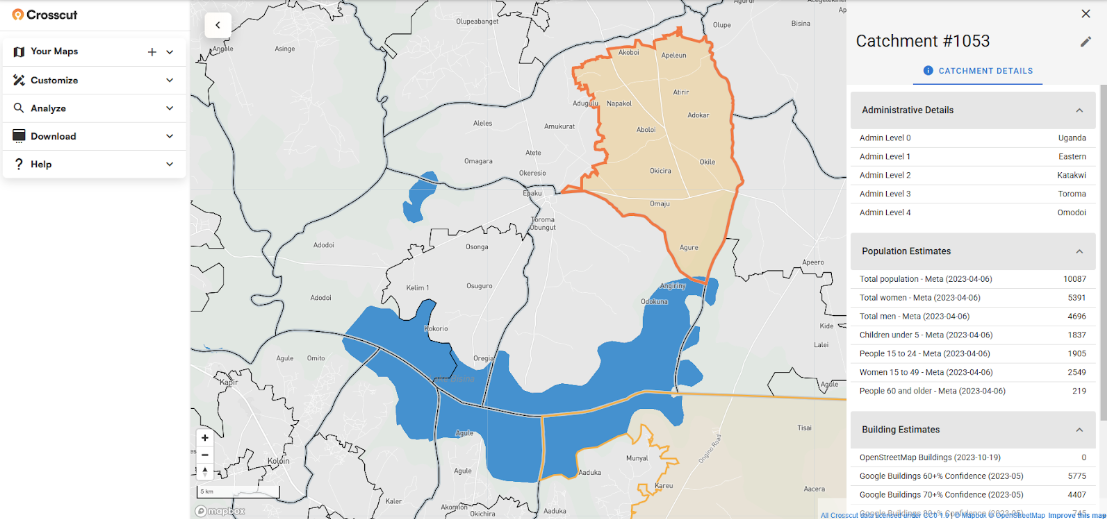
What the catchment map integration does for DHIS2 users
A health facility location tells you where a clinic sits on a map. A catchment area tells you which communities it serves, how many people live in them, and how accessible the facility is for each. Without that information, the data already in DHIS2 has no geographic foundation to build on.
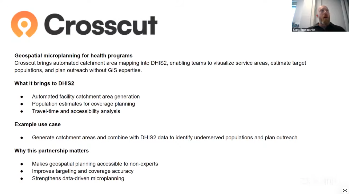
The Crosscut App has been available in the DHIS2 App Hub since 2022. It lets health teams generate catchment area boundaries for their DHIS2-registered facilities and publish them directly into DHIS2. Since then, the integration has deepened. Users can now view their catchment area and the population data behind them together in the DHIS2 Maps module, without needing to open the Crosscut App separately to access that information.
The Crosscut App generates those boundaries using population density, road networks, elevation, and land cover data. The process happens in one place, and takes minutes rather than days of specialized GIS work. Once catchments are published to DHIS2, teams can:
- Generate catchment area boundaries for health facilities and publish them
- Estimate target populations per catchment area for supply and coverage planning
- Visualize travel time to facilities for outreach and session planning
- Create thematic maps in DHIS2 by combining catchments with DHIS2 reporting data
"Crosscut is a fantastic platform to help create catchment areas for health facilities or other points like schools. This is not a native functionality of DHIS2. We depend on Crosscut to be able to do that." - Scott Russpatrick, DHIS2 Strategic Advisor
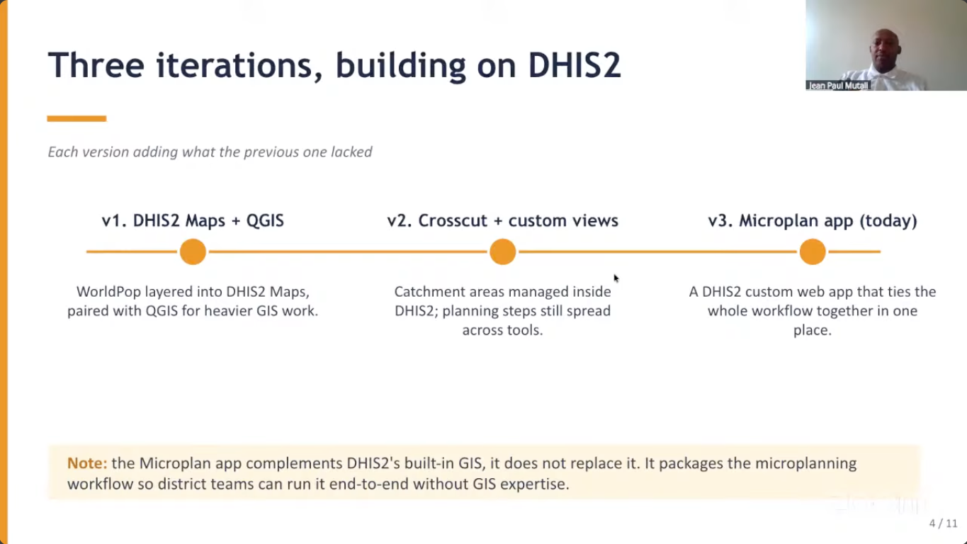
Example: Catchment maps in the Central African Republic
The day before the partnership announcement, I presented at a DHIS2 immunization microplanning webinar organized with Gavi. Jean Paul Mutali of HISP Rwanda, a digital health organization building DHIS2-based vaccination infrastructure, presented on his use of the Crosscut App in their campaigns.
His team has been working in the Central African Republic with no published census since 2003, and active insecurity in some regions. Planning campaigns there with spreadsheets and estimated population figures meant communities got missed, year after year.
Jean Paul walked through three versions of their mapping solution workflow. They started with DHIS2 Maps and QGIS, moved to the Crosscut App when district staff needed something simpler, and ultimately built a custom DHIS2 app consolidating the entire workflow. That app now loads WorldPop population data into DHIS2, maps settlements against catchment areas, supports cold-chain planning, and reconciles population targets against DHIS2 figures in one place.
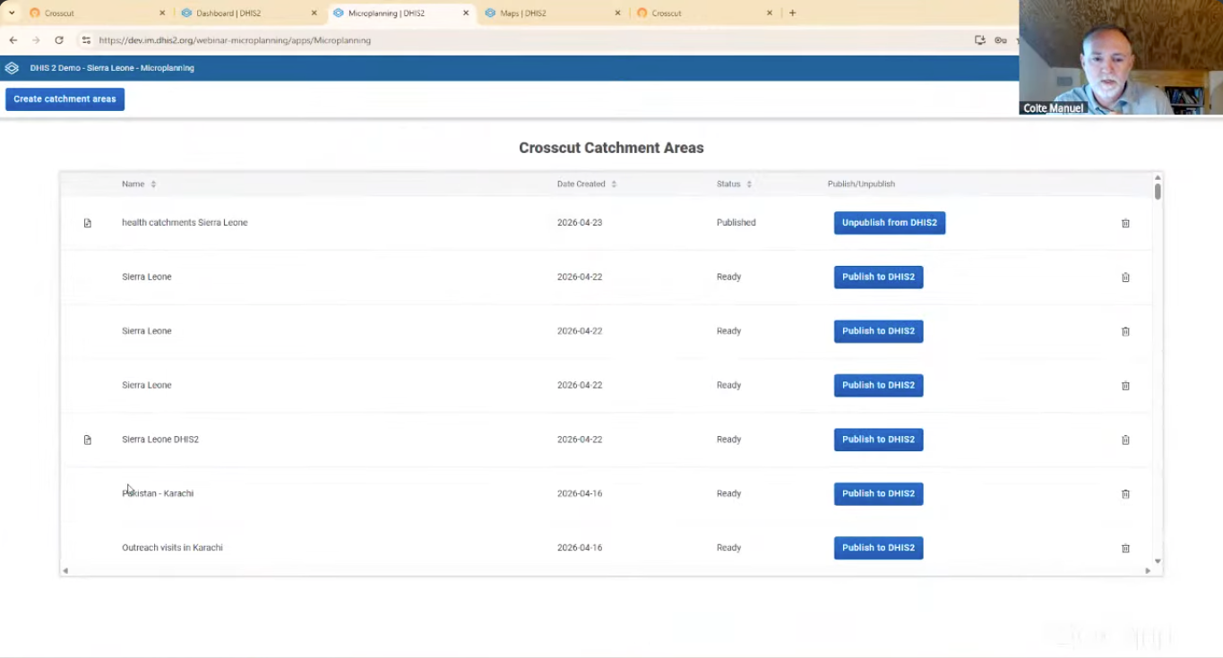
After his presentation, I followed with a demo of how the Crosscut App actually generates catchment area maps and publishes them into DHIS2.
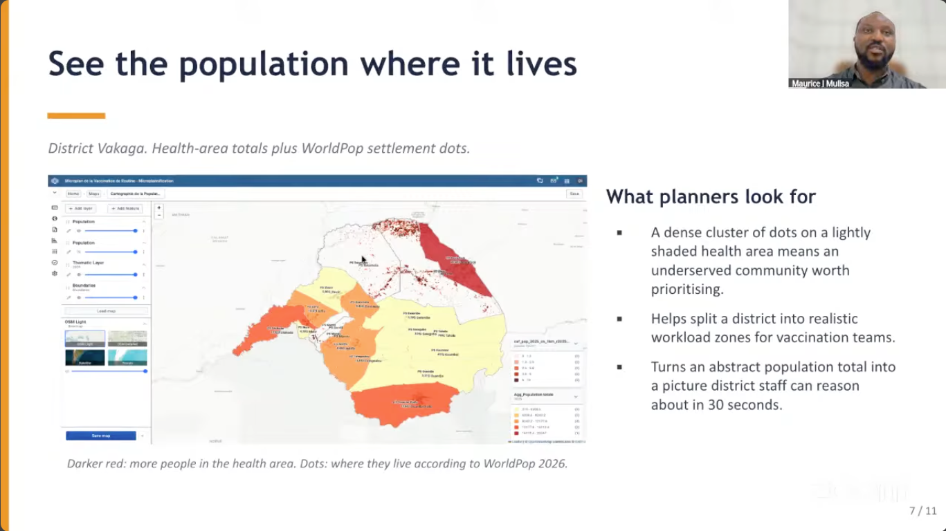
Maurice Mulisa, another member of the HISP Rawanda team, then showed the full workflow. They take catchments published from the Crosscut App into DHIS2 Maps, WorldPop data layered in by age group, and vaccination coverage tracked against those figures as the campaign runs.
A trusted answer to a hard planning question
Governments and health programs have always struggled to know which planning tools they can depend on from one year to the next. I presented at the WHO ESPEN annual meeting in Lilongwe earlier this month and heard the same question there. DHIS2 has proven to be a rare exception, surviving multiple funding cycles and political upheaval to become the kind of platform nobody gets questioned for recommending. When their team publicly says they depend on our integration, that changes conversations in ways we help more teams in more places.
That is what this designation represents to us. Not a marketing credential, but a public answer to the question everyone keeps asking. The integration is real, the work has been sustained, and the Crosscut app integrates across the tools programs already use, from Excel and email-based data collection to CommCare and ODK data collection for field teams.
If your organization uses DHIS2 and needs catchment areas in the system, the Crosscut App integration is free to use. For more complex situations, we are happy to talk through your needs.
Related Posts

How to set up a Microplan Collector project in the Crosscut App

May 2026 updates: Shared microplan projects and easier supervision analysis

How to find the communities your health campaign is missing
.JPG)
