
How to create catchment area maps in DHIS2 with the Crosscut App


Most health teams we work with run their programs in DHIS2. The globally-recognized health management information system holds their facilities, coverage numbers, and other data generated by health programs. One thing it doesn't do on its own is draw catchment areas, the boundaries that show the area a facility serves, how many people live inside it, and how easily they can reach it. That is the functionality Crosscut adds.
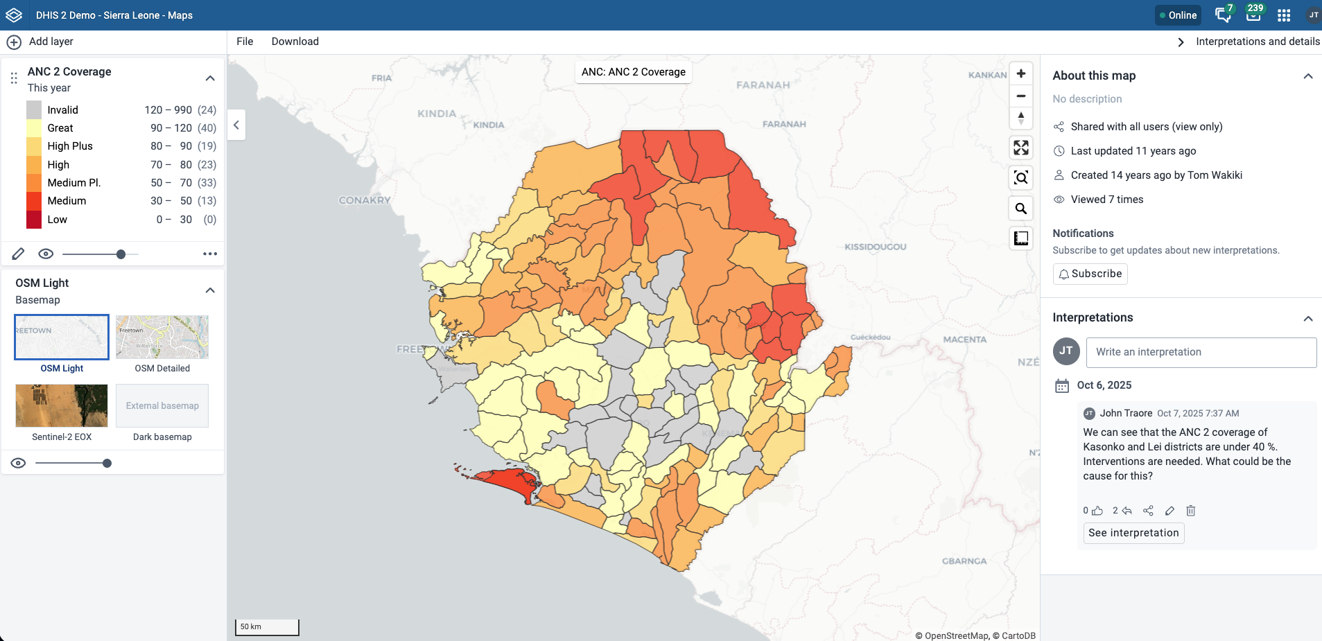
The Crosscut Microplanning App lives inside DHIS2 and lets you build catchment areas for your sites and publish them back into DHIS2, without leaving the system your data already lives in. This is the work I demoed at the DHIS2 annual conference this June, and part of why we became a DHIS2 Strategic Technology Partner.
This guide walks through creating catchment area maps in DHIS2, including how to open the app, create catchment areas for your DHIS2 sites, publish them, and put them on a map. I will use a public DHIS2 demo instance so you can follow along, and the steps run exactly the same on your own country's data if you upload your facility locations in DHIS2.
What you need to create catchment area maps in DHIS2
Before you begin, make sure you have:
- A DHIS2 instance running version 2.38 or later. The Crosscut Microplanning App shows up in the DHIS2 App Hub from that version onward.
- Sites with coordinates in DHIS2. These are usually health facilities, but any points work, including communities, schools, and outreach posts.
- A free Crosscut App account. If you do not have one, you can register in about a minute. You sign in once to connect the two systems.
ℹ️ Want to follow along? You can open a public demo instance at im.dhis2.org/public/instances, which is where these screenshots come from. Sign in with the demo credentials, user admin and password district. These instances reset on a schedule, so anything you publish there is temporary and good for practice.
Step 1: Open the Crosscut Microplanning App
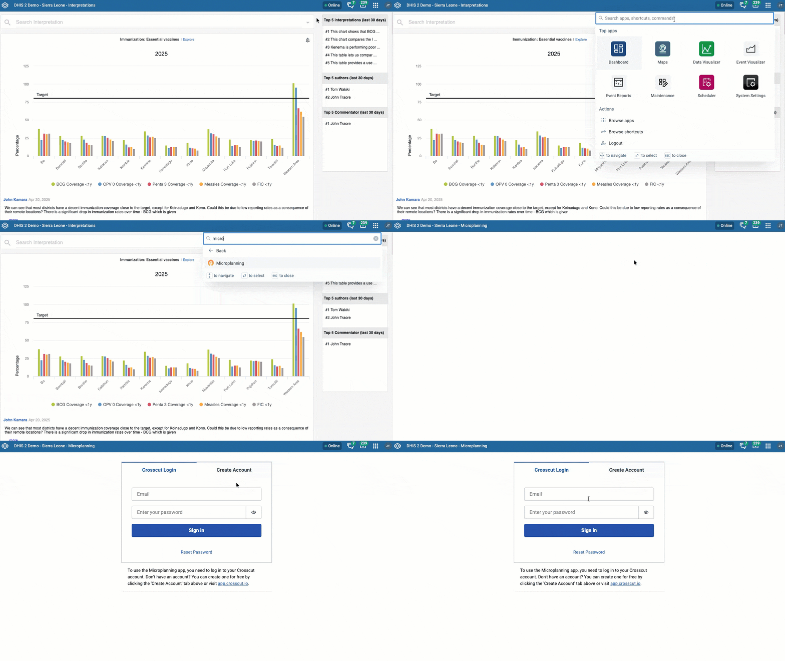
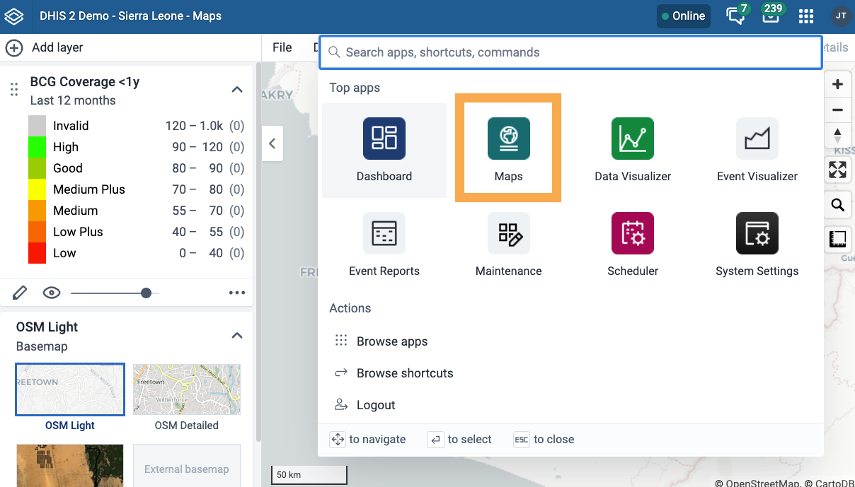
In DHIS2, type "Microplanning" into the app search and open the Crosscut Microplanning App. You sign in with your same Crosscut account login, which links your DHIS2 session to your Crosscut projects automatically.
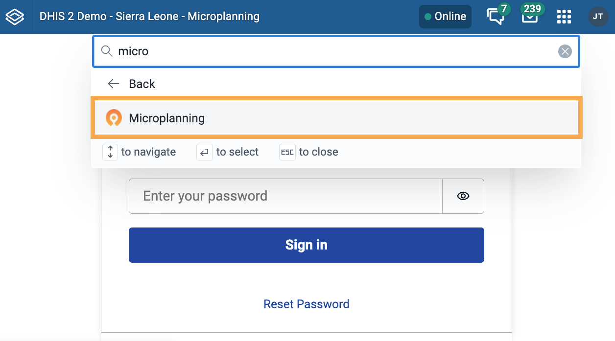
The Crosscut Microplanning App runs right inside your existing DHIS2. If it is not there yet, someone installs it once through the App Hub under App Management, DHIS2's built-in app store.Installing it applies to the whole instance, so a DHIS2 administrator usually handles it. On most programs the data or program manager asks their administrator to install it one time, and from then on anyone with access just opens it and works. We are also building toward a single sign-on, so even the separate Crosscut login goes away.
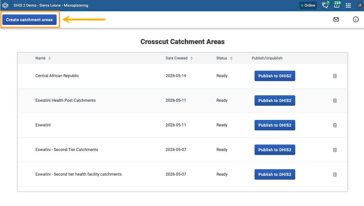
Step 2: Create your catchment areas
Click Create catchment areas.
Pick your country, choose whether to map the entire country or a specific area, and give the set a name you will recognize later. Then choose the organizational unit level your sites sit at: this is typically at the facility level, but some users hold sites at other levels such as communities. The names of these levels can change from one country to the next, so pick the one that matches your sites. Click Create.
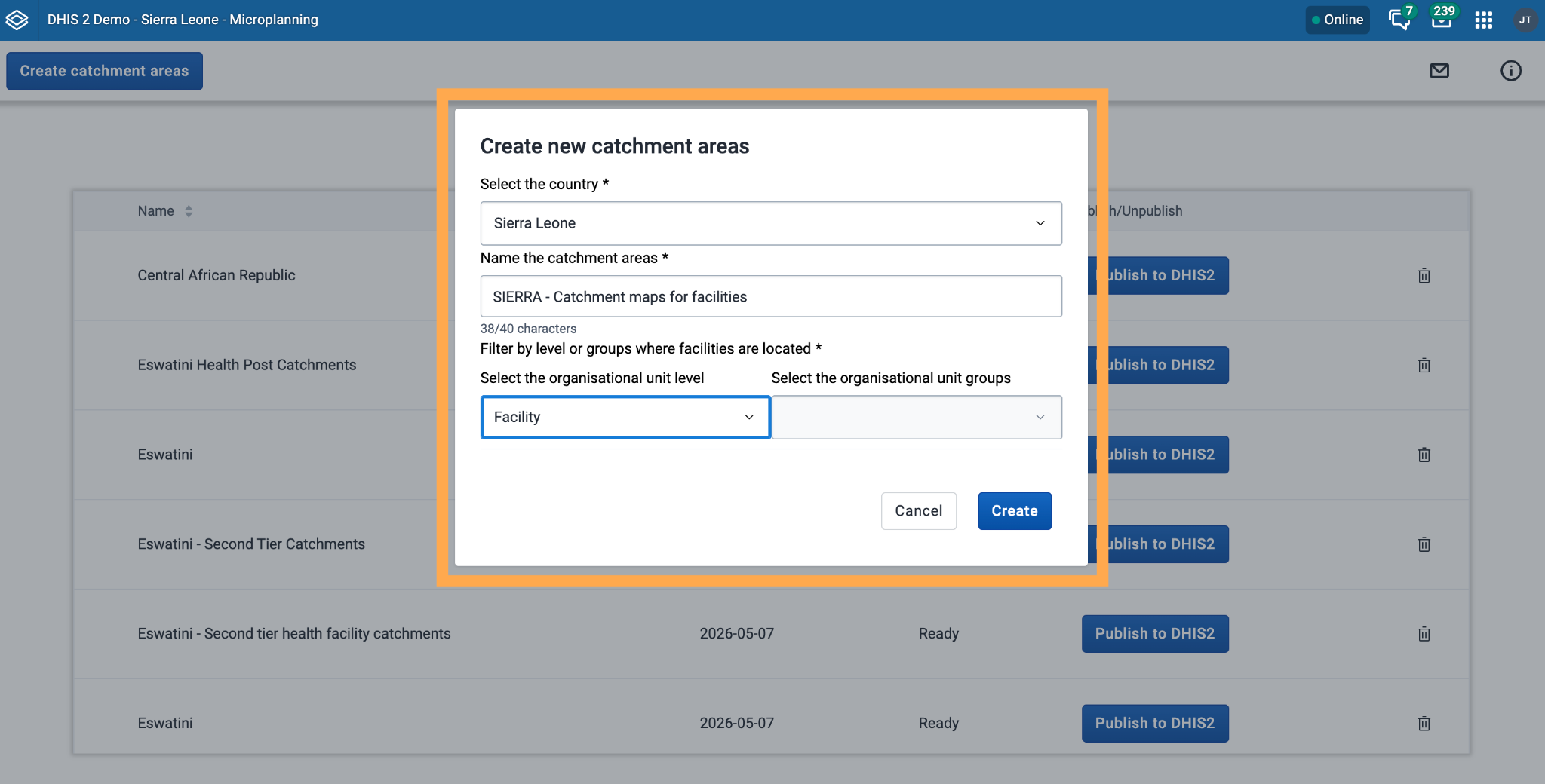
From there the app does the geographic work. It takes your DHIS2 sites and runs them against public datasets for population, roads, rivers, elevation, and land cover, then draws a catchment area around each site based on how people would likely travel to it. If the concept is new to you, here is what a catchment area is and why programs use them.
Step 3: Publish your catchment areas to DHIS2
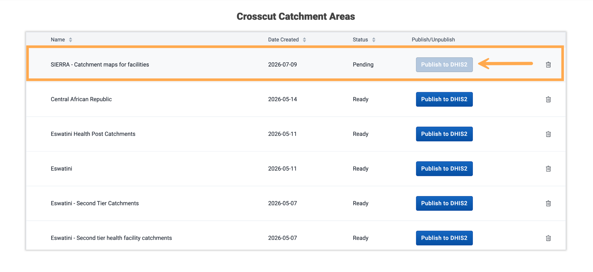
After the geospatial calculations finish, your new set appears in the project list with a status of Ready. Click Publish to DHIS2. That writes the boundaries the Crosscut App draws into your DHIS2 instance and attaches each one to the facility it belongs to, so the shapes line up with the sites already in your system. The same list lets you unpublish or remove a set whenever you need to.
Step 4: Put your catchment areas on a map
Open the DHIS2 Maps app and add a thematic layer. On the Data tab, pick the indicator you want to map. This walkthrough uses BCG Coverage <1y, a routine vaccination coverage indicator, and in your own DHIS2 you would choose whichever campaign or coverage indicator you want to analyze.
On the Org Units tab, set the level to Facility and add the layer. By default your facilities’ GPS points show up as colored points, each one carrying its own coverage value.
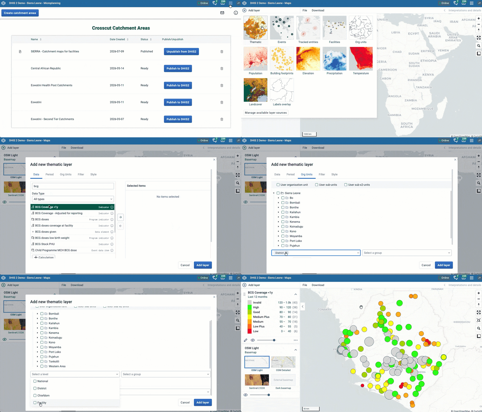
Now edit that same layer, return to the Org Units tab, and under use associated geometry choose the catchment set you published. Update the layer.
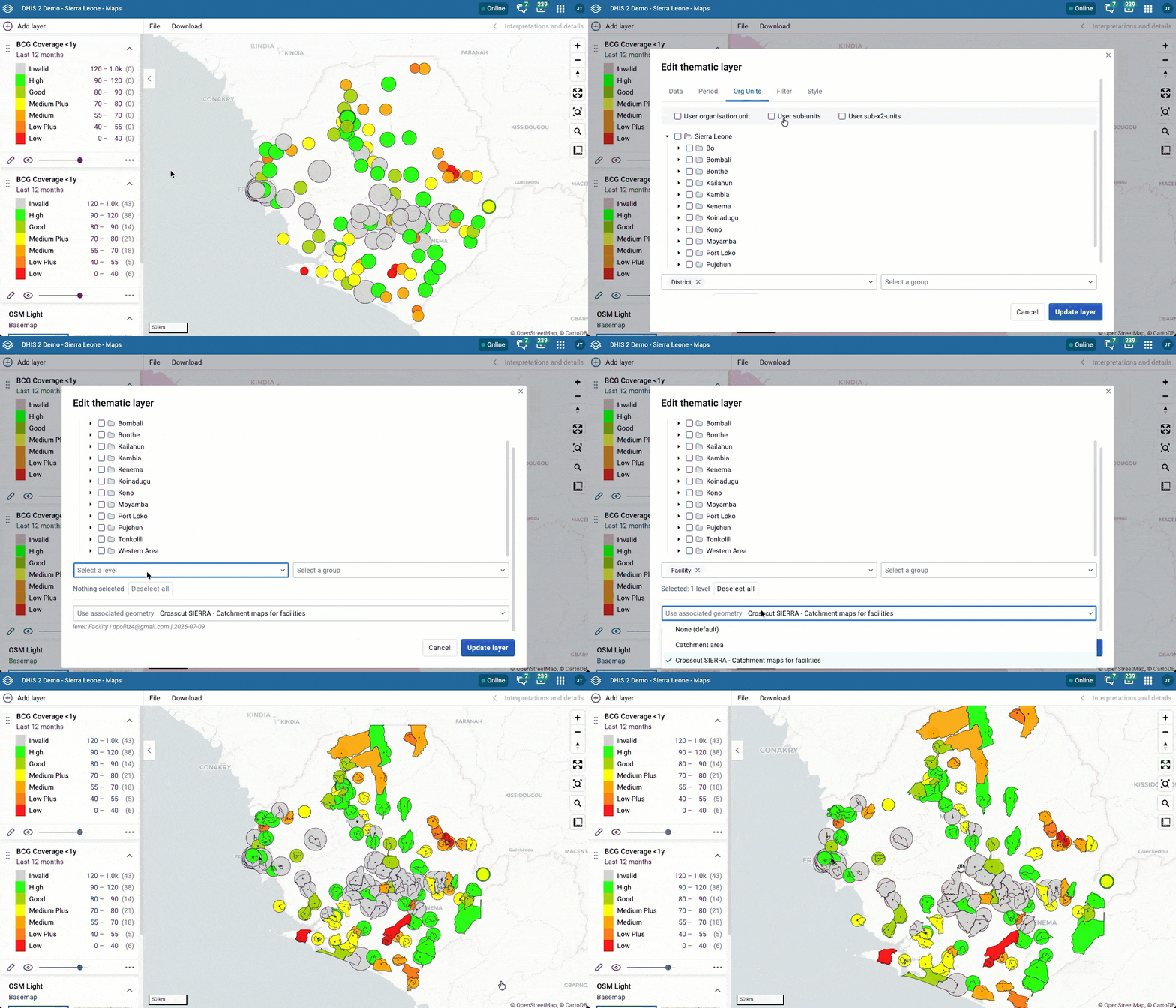
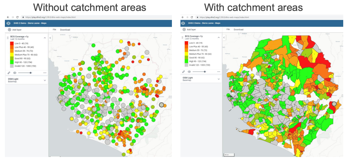
Your facility data now displays as catchment areas instead of dots. In the default point-based view, you can see the precise location of each facility while the colors of the dots capture each facility's coverage, but translating this information into an understanding of coverage across the country requires extremely difficult cognitive leaps. The catchment-area based view eases this cognitive load by displaying the geographic territories that are likely to be impacted by each facility’s coverage rate.The shaded view turns a jumbled set of points into something you can plan around.
Where catchment area maps in DHIS2 are headed
The catchment areas you create in DHIS2 also show up in your Crosscut App projects. Maps you build in the Crosscut App can publish out to DHIS2. They move between the two, which is what the DHIS2 integration is for. Once a catchment map is in the Crosscut App, editing it is simple. When your team knows there have been changes for where boundaries should fall, you can redraw them by hand about as easily as in MS Paint,

Today the DHIS2 side does one job well. It draws catchment areas for your sites and publishes them where your program data already sits. We are bringing more of that toolkit directly inside DHIS2 from here, so you will estimate target populations, check travel time to each facility, and plan supplies without leaving the system. The standalone Crosscut App will still be free to use and open across all 55 Sub-Saharan African countries.
Adding catchment area maps to DHIS2 account
Catchment mapping is the layer DHIS2 does not have on its own, and now it sits right next to the facilities, coverage figures, and reporting your team works in every day. Once you publish a catchment area map, they update alongside the rest of your program data.
The Crosscut App is free to use. If you are setting up a new project, these guides cover other parts of the potential workflow:
- What is a catchment area? A GIS guide for non-technical teams – A plain-language introduction to catchment mapping for anyone new to the concept.
- How to create catchment area maps from GPS locations – Build the catchment project this integration sits on top of.
- How to find the communities your health campaign is missing – Sepot the settlements left off your program lists by mapping them against your catchments.
- How to set up a Microplan Collector project – Collect community population data over email and Excel, then map it.
Frequently asked question: Making catchment maps in DHIS2
Can DHIS2 create catchment area maps on its own? DHIS2 stores your facilities, coverage figures, and reporting, but by its own documentation it does not create catchment areas natively, though they can be created through a third-party service such as the Crosscut app and registered as associated geometry. You add that capability with the free Crosscut Microplanning App, which installs from the DHIS2 App Hub in version 2.38 and later and builds catchment areas for your sites without leaving DHIS2. DHIS2
How do I create catchment areas in DHIS2? Open the Crosscut Microplanning App in DHIS2, click Create catchment areas, then choose your country and the organizational unit level your sites sit at. The app draws a catchment around each site using public data on population, roads, rivers, and terrain, and once you publish the set, the boundaries attach to the facilities already in your DHIS2.
How do I display catchment boundaries in the DHIS2 Maps app? In the Maps app, add a thematic layer with your indicator set to the facility level, then open the layer's Org Units tab and set "use associated geometry" to the catchment set you published. DHIS2 treats the catchment as the org unit's associated geometry and shades your facility data across it instead of showing single points, so you read coverage across the whole map at once.
What is a catchment area in health program planning? A catchment area is the geographic area a facility serves, drawn from how people actually travel to it rather than a plain circle on a map. A useful catchment also carries the population living inside it and how easily they can reach the facility, which is what turns a list of facilities into a coverage picture you can plan around.
Do you need GIS skills to make catchment area maps? No. The Crosscut App runs the geographic modeling from a simple list of sites, so work that once needed a GIS specialist and days of prep now takes minutes. Anyone comfortable working in DHIS2 or a spreadsheet can create, publish, and edit catchment areas by hand.
Related Posts
.png)
What are never treated communities, and how does WHO’s new toolkit help NTD programs find them?

What GPEI's polio outbreak guidance says about catchment area maps
What WHO's routine immunization guide says about catchment area maps
