
Madagascar's schisto MDA: Getting 19 district microplans into one place

Madagascar treats schistosomiasis through mass drug administrations (MDA), where health teams give preventive medicine to everyone in a targeted area over a specified number of days. The country’s campaigns covered whole districts until 2025, when a national impact assessment found infection rates varying widely between communes inside the same district.
As a result, the Ministry of Health began looking for ways to target individual communes. Unlimit Health was tasked with identifying alternatives, and asked us to support the microplanning for the June 2026 campaign across 19 hyper-endemic districts. We had worked with their team on schisto before, drawing health facility boundaries in DRC.
This article covers why the program's microplans started by matching administrative names, how the 19 districts came together in the Crosscut App (in just 16 days), and what the upcoming national campaign in December 2026 will require.
Why the program needed a shared microplan repository
Unlimit Health and the MoH in Madagascar originally wanted travel-time analysis and a fairer way to allocate CDDs. The challenge in these cases is that neither of these tasks can be done without a complete, agreed-upon list of every community and its population. The MoH did not have that list in usable form for the campaign.
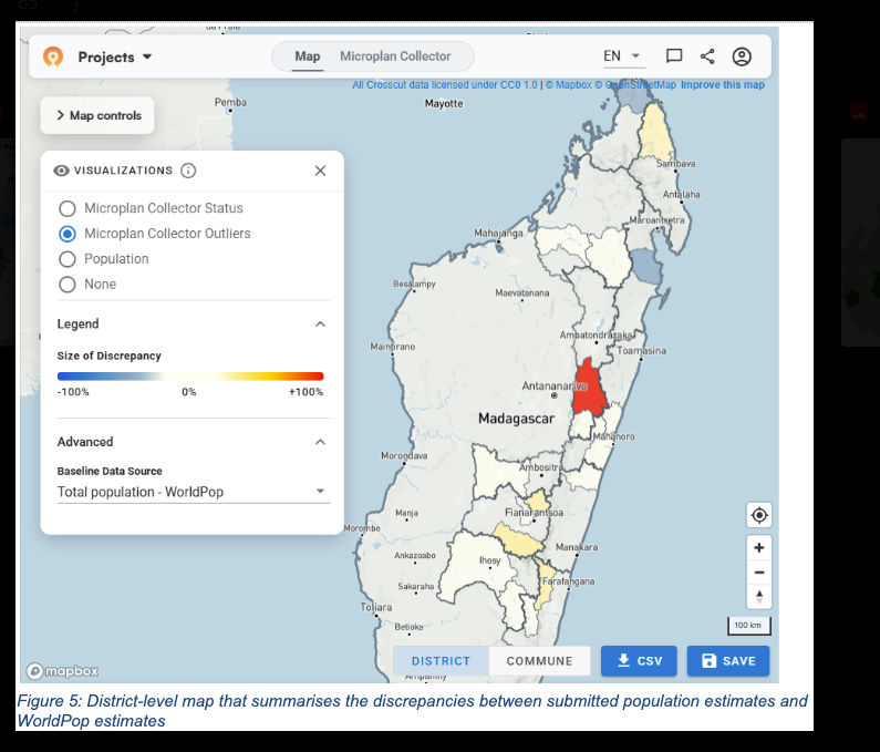
The existing workflow was for the 19 district microplans to be emailed as separate Excel files to the central team, but there was no way for them to see all 19 at once. The objective for June was to get every district microplan into the Crosscut App, in one project, before the campaign started in earnest. June was a first round rather than a full microplanning implementation.
How the Microplan Collector consolidates Excel microplans sent by email
The Geospatial Microplanner from the World Health Organization AFRO Region's Expanded Special Program for Elimination of Neglected Tropical Diseases (ESPEN) is a white-label version of the Crosscut App. The free online platform for campaign planning is built around basic spreadsheets and email, the way most health programs already run their microplanning campaigns.
District teams fill in the same template they always have and send it to the same address. The Crosscut App reads each file as it arrives, adds it to one database, shows who has submitted, and puts the communities on a map. We built the same workflow for Senegal's national template the year before, and Sightsavers runs it in Chad.

The templates go out with the administrative names already filled in, so district teams only enter their population figures. Matching those names to the platform's geographic records before anything is sent is where many programs get caught up, and what we helped with in this case.
Harmonizing administrative names with fuzzy matching
The Crosscut App connects a geospatial microplan to its geography on a catchment map by name. Every commune and every fokontany, the smallest administrative unit in Madagascar, has to be spelled the same way in the template, and in the platform's geographic records, before any of it can appear on a catchment area map.
Most programs have never had to meet that standard or specificity. People are reading these lists, and a person with knowledge of the area can usually work out two slight spellings referring to the same village. But a computer treats them as two different places and the match won't link.
Before mapping anything, we worked through the entire matching process with the MoH team and Unlimit Health, standardizing the template and matching names against the platform's records over several rounds. This “fuzzy matching” workflow only has to be done once.
After the first pass of fuzzy matching the program has a clean list, and the job shifts from correcting thousands of records to correcting the few that change each year.
Two remote training sessions, six guides, and 19 microplans in 16 days
With the template mostly settled and the names matched, the districts could start filling it in with their data. Before that, we ran two remote training sessions in French for the central MoH team.
- Session one covered platform setup, template data entry, and day-to-day coordination between districts and the central team.
- Session two, once submissions started arriving, covered the review dashboard and the map view.
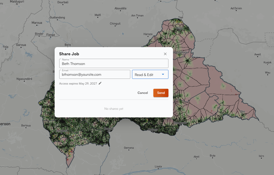
The central team then sent the template to all 19 districts, working from six French-language guides we wrote so they would not have to book time with us. Several of them needed to monitor submissions at the same time, which a Microplan Collector project could not support then, so we added project sharing to the Crosscut App during the engagement.
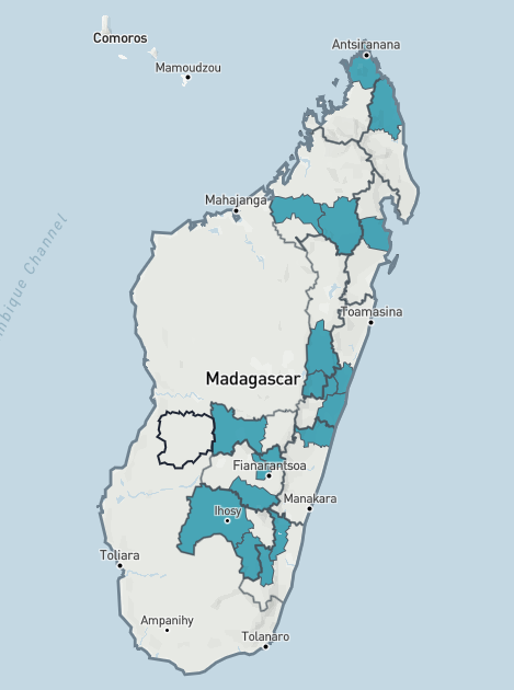
District microplanning started on 24 May and all 19 microplans were confirmed on 9 June, a 16-day window that closed a week before launch. The MDA began during the week of 16 June with no delays caused by planning. Their project in Crosscut held over 1,000 communities across 124 communes, and the central team could view it on one screen. Several told Unlimit Health it was the first time they had reviewed their microplans together as a group.
Table: Four things changed between May and June.
Next steps: Scaling up from 19 districts to 115 in December
We handed over the technical review at the end of July. Madagascar is considering a national campaign in December across roughly 115 districts, six times the June footprint, and the June round exists partly to inform that decision.
June produced a working template, a tested collection process, and a central team that has run it once. It was scoped to collect and consolidate the planning data, which is the step that has to come first. The analysis Unlimit Health and the MoH asked for at the start is the next one:
- Travel-time and accessibility mapping to find the communes that are hardest to get to
- Fair allocation of community drug distributors based on rural transit time rather than a fixed population ratio
- Supervision tracking showing which communities have been visited by supervisors while the campaign is still running
All three of these features depend on knowing where things are in relation to each other, which means every commune needs a boundary and every health facility needs GPS coordinates. The facility coordinates are still to come. Doing this work at 115 districts is the same two jobs, just on a much larger scale.
Building on the success of phase one
What a larger scale-up in December could do with the data depends on how much of the boundary work gets completed between now and then. In our 2025 country projects with ESPEN, where that groundwork was already finished, an independent evaluator found these capabilities associated with 61,930 additional people treated and 463 previously missed settlements receiving a supervision visit.
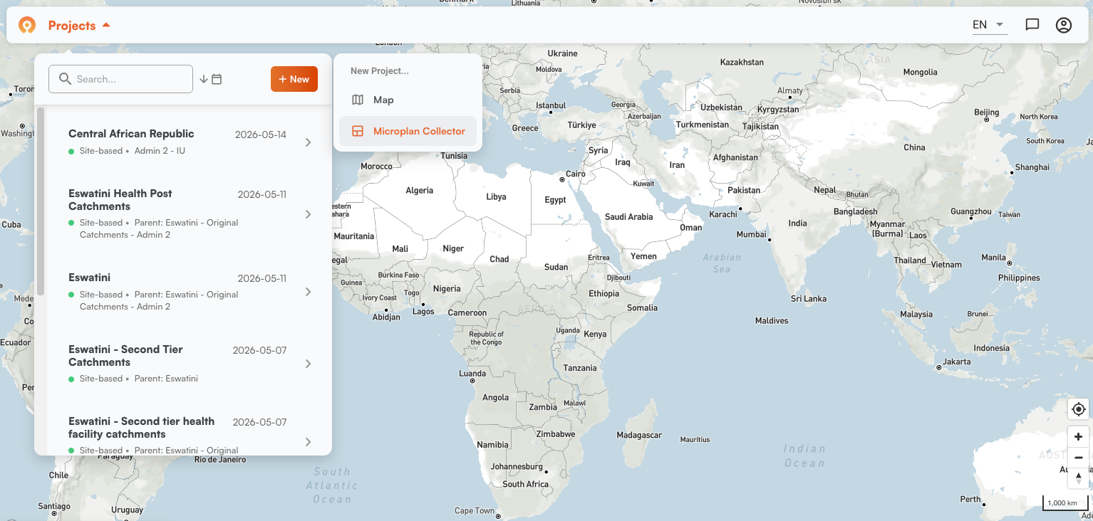
The Crosscut App is free to use, and you can set up a Microplan Collector project for your own campaign in a few minutes. Data such as population estimates and administrative boundaries already in place for all sub-Saharan countries across Africa. If you would rather walk through what the mapping side would involve in your program, reach out to us.
Frequently asked questions
What is the Microplan Collector in the Crosscut App?
It is the module of the Crosscut App that turns emailed Excel microplanning templates into one consolidated database. It sends pre-populated templates out to district teams, reads each return as it arrives, tracks which districts have submitted and which have not, and maps the communities against administrative boundaries. District teams need no account, no login and no new software, because they keep working in Excel and email the way they already do. Setting up a project takes a few minutes.
Why does schistosomiasis mass drug administration need commune-level microplanning?
Infection rates vary sharply between communes in the same district, which is what Madagascar's 2022 to 2024 impact assessment found. Once a program treats individual communes instead of whole districts, in line with WHO's 2022 guidance, planning has to identify which communities fall inside each target area, how many people live in each one, and how much praziquantel and how many distributors each commune needs. WHO and PAHO's NTD microplanning manual sets out what that process is supposed to produce, and the same logic applies to malaria campaigns and indoor residual spraying.
How do you match administrative names between a microplanning template and geographic data?
Through fuzzy matching, which compares spellings and scores how close two names are rather than demanding an exact match. Programs usually carry small variations across their datasets, because people read those lists and a person has no trouble seeing that two spellings mean the same village. A computer does not. We walk through how the matching works across African administrative datasets, and the work only has to be done thoroughly once, after which it becomes annual maintenance.
What has to be in place before travel-time and accessibility analysis?
Three things. Administrative names have to match between the program's list and the geographic data. Every commune needs a boundary it can be linked to. And health facilities need accurate GPS coordinates, since travel-time analysis measures outward from a known point. With those in place you can build catchment areas from GPS locations and start finding the communities a campaign is missing.
Can a national program run geospatial microplanning without GIS staff?
Yes. District teams work in Excel and email throughout and never touch the platform. The central team needs enough training to review consolidated data and read the map, which took two remote sessions in French in Madagascar. If your team has GIS capacity and wants it, catchment areas can be edited in QGIS and the Crosscut App is a DHIS2 technology partner, so outputs can go straight into DHIS2.
What happens when a commune has no boundary in the geographic data?
It cannot be drawn on a map, but it can still report. Its population still rolls up into district totals. The gap is usually a mismatch between a national boundary file and a commune list that has changed since that file was last redrawn, so resolving it means going back to people who work in the district rather than changing anything in software. If you are new to the underlying concepts, our GIS terminology guide and what a catchment area is cover the vocabulary.
Related Posts
What WHO's NTD microplanning manual says about operational maps

.png)
What WHO's indoor residual spraying manual says about catchment area maps
Microplanning guides for health campaigns: A program-by-program reference
