
What WHO's new campaign integration guide says about shared maps and data
At the DHIS2 conference in Oslo this year, Coite pointed out that nearly every conversation came back to integration. Health programs want to plan from shared platforms and shared data instead of running parallel systems that never touch. We heard similar requests from program managers at ESPEN's annual meeting in Lilongwe and at WHO's Brazzaville workshop.
WHO has now turned that conversation into campaign guidance. Implementing integrated health campaigns: Decision-making and planning guide is the first on deciding when and how to combine health campaigns, written for the national programs that each run their own.
Here’s what the guide says about deciding what campaigns should share, from data and tools up to fully combined delivery.
What counts as an integrated health campaign
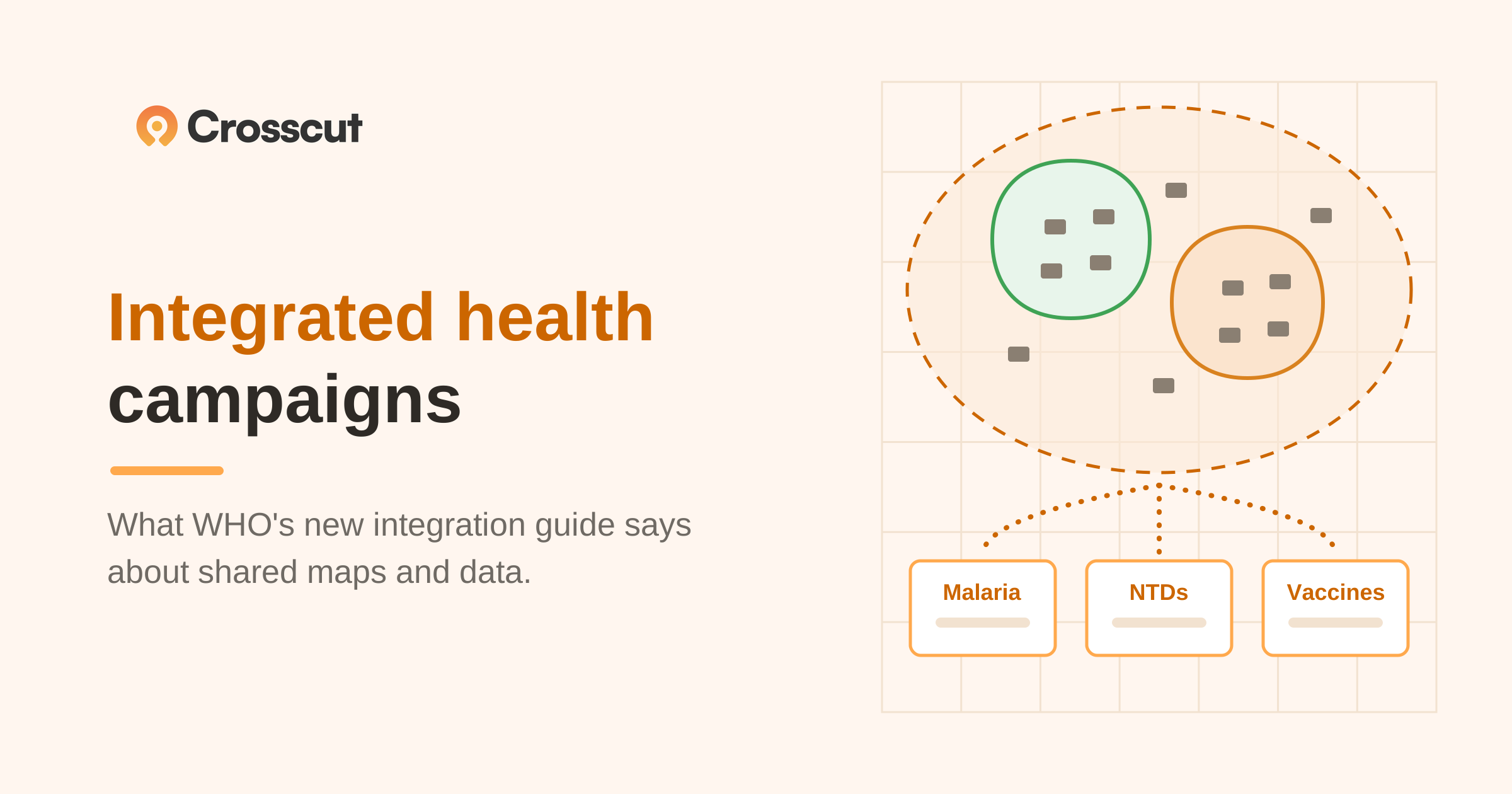
An integrated campaign does not have to mean delivering every intervention together. The guide defines integration as coordination between programs, stakeholders, and the country health system. Campaigns can be fully integrated (where interventions are co-delivered), or partially integrated (where programs share specific functions or components, like data, tools, or monitoring), even when joint delivery isn't feasible.
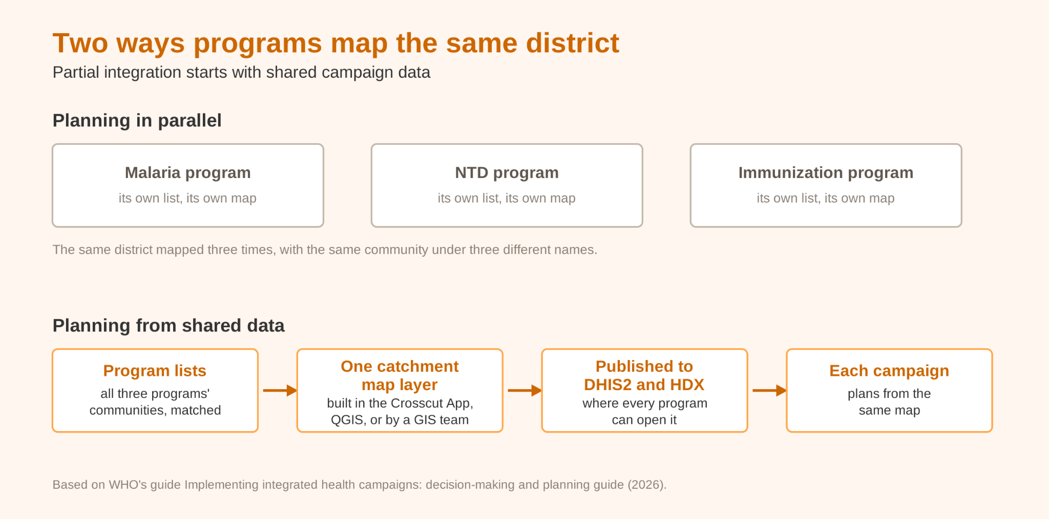
That partial category is the one most programs can act on as early as this year. Among other benefits, two programs that share community lists and maps are already partially integrated, have a general shared understanding of the same areas and health facilities, and no one has to merge a campaign to get there.
Integration can help share costs, improve coordination, and reduce burdens on community and health workers who otherwise receive separate campaigns months apart. It also demands more planning, more logistics, and enough trained people to deliver several interventions well.
One of the main reasons campaigns are not more integrated is because most planning today still happens in parallel. There is no or limited communication between many health campaigns, and those inefficiencies strain health systems and limit how many people campaigns can help. The demands mostly come down to lead time and coordination, and the guide's five-step process addresses both hurdles.
The five steps for deciding what to integrate
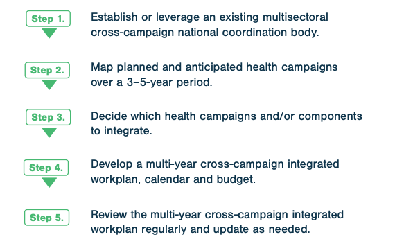
Whether or not to integrate campaigns often depends on the team’s level of coordination more than mapping alone. A national coordination body looks across every campaign the country expects to run and finds where they can share. The guide breaks that work into five steps:
- Establish a cross-campaign coordination body, or work through one that already exists
- Map every planned and anticipated campaign over the next 3 to 5 years
- Decide which campaigns or components to integrate
- Build a multi-year cross-campaign workplan, calendar, and budget
- Review the workplan regularly and update as needed
The steps themselves are about governance. The rest of the guide covers what the plan needs on the ground, and that is where catchment area maps and shared data do the work.
Are programs using the same maps and population data?
The guide's planning checklist asks whether health programs are using the same maps and target population information, or whether different methods are being used to identify and reach the same hard-to-reach populations. For most ministries the honest answer is the second one. Malaria, NTD, and immunization programs each keep their own community lists, the lists drift apart over time, and the same community can appear under three names in three systems. A no here doesn't rule out planning together. It means harmonizing the lists and maps comes first.
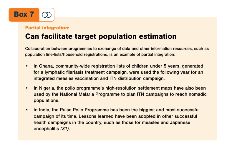
The guide's country examples show what happens when programs share instead. In Ghana, registration lists of children under 5 built for a lymphatic filariasis treatment campaign were reused the following year for an integrated measles and insecticide-treated net (ITN) distribution campaign. In Nigeria, the malaria program planned ITN campaigns for nomadic populations on the polio program's high-resolution settlement maps. In India, the Pulse Polio Programme's methods carried into measles and Japanese encephalitis campaigns.
Each of those reuses worked because the data was somewhere a second program could find it. That is the problem we build for. The Crosscut App publishes catchment maps directly into DHIS2, the system where most ministries already manage program data, so a map built for one campaign is visible to every program planning in that system. We also publish our own settlement catchments through HDX, which any program in any country can download and reuse. The open datasets are the ones we build ourselves. Health programs keep their own campaign data private in the Crosscut App, where only their team has access.
What the guide says about integrated microplanning
The guide defines geospatial microplanning as planning at the level closest to service delivery, and warns that inaccurate data produces microplans that overlook critical populations, misallocate staff and supplies, and miscalculate coverage statistics. Some programs use geographic information systems to validate and improve their baseline population data.
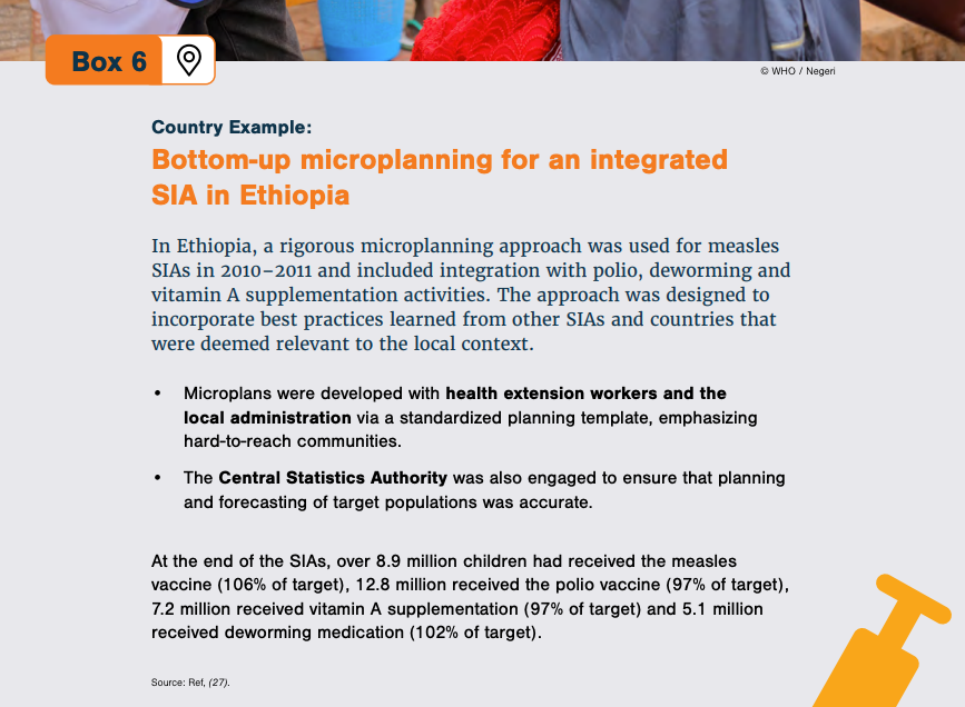
In the guide's Ethiopia example, teams built microplans from the bottom up with health extension workers and local administrators for integrated measles campaigns that also delivered polio vaccine, deworming, and vitamin A. The campaigns reached 8.9 million children with measles vaccine and over 5 million with deworming medication.
Local knowledge drove those microplans, and the Crosscut App keeps that in the workflow. Supervisors can redraw catchment boundaries by hand wherever they know the area better than the data does, and print the maps for planning sessions that happen on paper. An integrated microplan also gathers templates from more programs than usual.
The Microplan Collector validates and aggregates every emailed Excel submission into one dashboard so teams stick with tools they already use. Madagascar's schistosomiasis program used this tool to bring 19 district microplans into one project in 16 days this June.
WHO's African region offers the same tools through the ESPEN Geospatial Microplanner, a white-label version of the Crosscut App built into its ESPEN portal.
Population estimates and the communities campaigns miss
National population projections tend to less reliable at the local levels where campaigns operate, so the guide recommends estimating target populations several ways:
- Triangulate against related data, including the United Nations' World Population Prospects and global datasets like WorldPop, GRID3, and Meta
- Review existing target populations previous campaigns and programs used
- Use remote sensing or satellite imagery house counts to identify households
- Run household registration with communities and local leaders (time permitting)
Those are the same sources the Crosscut App builds its population estimates from, so teams can benchmark their microplan numbers against them without assembling the datasets themselves.
The guide also says good planning makes special efforts to find never-reached and zero-dose communities, the populations missed in remote, insecure, or urban slum settings. NTD programs call these never treated communities, and travel time analysis flags the ones beyond a program’s reach threshold.
Suggestions for monitoring integrated health campaigns
For monitoring, the guide tells programs to capture campaign data on existing government-owned platforms where possible rather than standing up something new. Its real-time monitoring box cites the same UNICEF and Gavi review we covered last week, so we'll point you to that article for how same-day campaign data works in practice, from daily supervision maps to dashboards every level of a program can watch.
What the guide recommends and where the Crosscut App helps
A starting point for programs planning together
The guide's five steps run on committees and workplans, but the considerations underneath them run on shared data, and the map layer is the piece most ministries are missing. A program doesn't need to wait for a fully integrated campaign to fix that. Publishing this year's catchment maps where the next program can find them is partial integration already underway.
If your program is working through the guide's planning questions, the Crosscut App is free to use for building the maps and population estimates that planning depends on. And if you're setting up integrated microplanning across programs, reach out to us or check out our advisory services.
Frequently asked questions
What is an integrated health campaign?
An integrated health campaign is one where different health programs coordinate with each other and the country health system, according to WHO's decision-making and planning guide. Integration ranges from fully co-delivered interventions to partial integration, where programs share specific components like data, tools, or monitoring.
What is partial integration of health campaigns?
Partial integration means programs share functions or components without delivering interventions together. Sharing community registration lists, settlement maps, or monitoring platforms all count. WHO's guide documents cases where one program's population lists and maps were reused by another program's campaign the following year.
How do health programs decide which campaigns to integrate?
WHO's guide lays out five steps: establish a cross-campaign coordination body, map all planned campaigns over 3 to 5 years, decide which campaigns or components to integrate, build a multi-year cross-campaign workplan and budget, and review it regularly.
How do integrated campaigns estimate target populations?
The guide recommends triangulating multiple sources rather than relying on one, including national projections, the UN's World Population Prospects, and global datasets like WorldPop, GRID3, and Meta. The Crosscut App builds population estimates from these same datasets, so teams can benchmark their microplan numbers against them.
Can health programs share community lists and maps across campaigns?
Yes, and WHO's guide treats shared population data as a form of partial integration. Publishing catchment maps into DHIS2 makes them available to every program planning in the ministry's system, and openly licensed catchment data on HDX extends the reuse further.
What tools support integrated campaign microplanning?
Programs combine data collection tools like CommCare, ODK, and KoboCollect with mapping and aggregation tools. The Crosscut App generates catchment maps from program lists, and its Microplan Collector gathers and validates the population templates an integrated microplan depends on.
Related Posts

What UNICEF and Gavi learned about real-time campaign monitoring for health campaigns

What are never treated communities, and how does WHO’s new toolkit help NTD programs find them?
What GPEI's polio outbreak guidance says about catchment area maps
